

McCabe Creek Trail
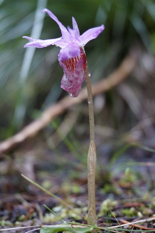
McCabe Creek makes for a fantastic hike three seasons of the year. In the spring, woodland wildflowers create colorful patches on the forest floor. In the summer, the largely shaded trail and streamside stops are a cool option on a hot day. In the fall, colorful foliage from aspen and low bushes again create a colorful mosaic. And, best of all, it’s unlikely that you’ll see many people along the way.
The trail begins behind four large boulders at the edge of the trailhead. The first 100 feet is wide along an old roadbed, then signed Trail #1104 becomes narrower as it ducks into the woods above McCabe Creek. Pass through a delightful mix of Doug fir, larch, and even aspen, then enjoy views down into McCabe Creek from occasional scree fields and meadows. The trail is well above the creek for the first 1.4 miles, at which point it approaches the stream near open cliffs. This is a great destination for a shorter hike, or continue to your hearts’ content with more access to the stream.
GETTING HERE
From Highway 200, turn north onto Monture Creek Road (right across the highway from the turnoff to Ovando) and drive 4.4 miles on well-graded Monture Creek Road. Turn right onto Forest Road 5401 and drive 2.5 miles. Arrive at the signed McCabe Creek Trailhead Parking, which is on the south side of the road and is wide enough to accommodate trailers.
Or, for passenger cars, save yourself .2 miles of walking: just past this parking area turn left onto Forest Road 17536 and drive 0.1 miles to the trailhead on the right. There is space for 3-4 cars in front of four large boulders marking the beginning of the trail. The sign marking the trail is 100 feet down the trail past the boulders.
TRAIL DETAILS
Roundtrip Distance
Total Elevation Gain
Highest Elevation
Trail Features
Seasons
Trail Type
Kid-Friendly
Vehicle Access
PLACES TO CAMP:
- Monture Creek – Lower: Lovely scenery along the meandering Monture Creek, just before it empties into the Big Blackfoot, with large secluded camping spots. This is near where Meriwether Lewis camped with his group on his return trip without Clark on July 6th, 1805. Take Highway 200 west approximately 5 miles to Monture Creek fishing access. There are parking spots and camping right off the highway, or follow the road back for more seclusion, and better fishing.
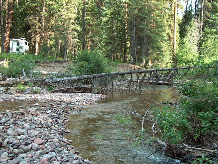
- Monture Creek – Upper: Beautiful timbered scenery amongst old growth forest near the boundary of the Bob Marshall Wilderness. From the west Ovando exit, cross Highway 200 right onto Monture Creek Road. Continue up for about 15 minutes. The bridge will cross over the Creek and parking and camping are available.

FILL YOUR BELLY:
Check out the charm of Trixies in Ovando. Great spot to belly up to the bar and order a steak: