Tag Archives: Lithia

Flee the smoke with Jack and Lithia!

It’s not just a physical sensation – it’s a mental one as well.

We’re talking about the feeling that we’re all getting suffocated by this enduring wildfire smoke.

Yeah, all that coughing is making it harder for Jack to hone his incredible collection of pick-up lines; but the associated claustrophobia has also boosted his neurosis to unprecedented levels.

Chicks just don’t seem to care too much for Jack when he’s sweating, convulsing and passing out BEFORE he even downs his first can of cool brew.

So this month, Jack’s inviting you to all join him on a road trip out of town to one of the few areas where the sky remains clear. We’re talking about a campout at Deadman Lake in far, far southwestern Montana – in the Italian Peaks Proposed Wilderness.

And to further pique your interest, our friends at Lithia Ford of Missoula are throwing in a tire mount and balance for one lucky winner. Oh, and by the way, you’re driving; Jack will provide the entertainment.

Read on for directions, tips and what to expect at Deadman’s Lake, and don’t forget to CLICK HERE to sign up for your free tire mount and balance!


Deadman Lake #91

Round Trip: 16 miles

Total Elevation Gain: 1,096 feet

Directions: From Missoula, head east on I-90 like you are headed to Butte, but just before Butte you’ll take I-15 south. Head through Dillon, and then about 45 miles past town you’ll take Exit 23 at Dell.

wmt41ff882550b37c9b7Turn right at the bottom of the off-ramp and then take an immediate left onto Westside Frontage Road. About 1.5 miles down you’ll come to Big Sheep Creek Road – turn right (west) here.

Follow Big Sheep for 18 miles – and when it branches, take the left fork towards Nicholia-Deadman on FR 3927. Stay on the road until you see Nicholia Creek Road, and then follow that to the lake.

We highly recommend you check out a map before setting out on your journey.

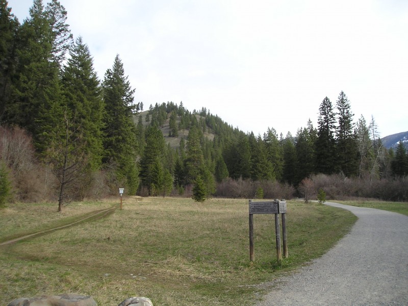
What to expect: This hike covers about one-third of a 23-mile lollipop-shaped loop through a lush valley with views of the Italian Peaks.

Starting at Deadman Lake, hike south upstream following a dirt trail that at times is faint and grown over. After taking the lefthand branch early on, hike into the valley surrounded by high, cavernous cliff faces following the sometimes dry creek bed through meadows and old lake basins. Take this path for around 6 miles and then the trail begins to take a slight dip into the trees on the righthand side. Continuing for a couple hundred meters look for the sub-trail branching across the river and up the hillside to the left.

This branch was a little bit difficult to find even with a trail map; look for the branch just south of the mountain with an eastern cliff face. Once on this trail, there are a couple switchbacks to the top of the hill. This climb is the most difficult part of the hike. Around a mile after taking the sub trail, cut down on the other side of the hill to a small but oasis-like Divide Creek Lake.

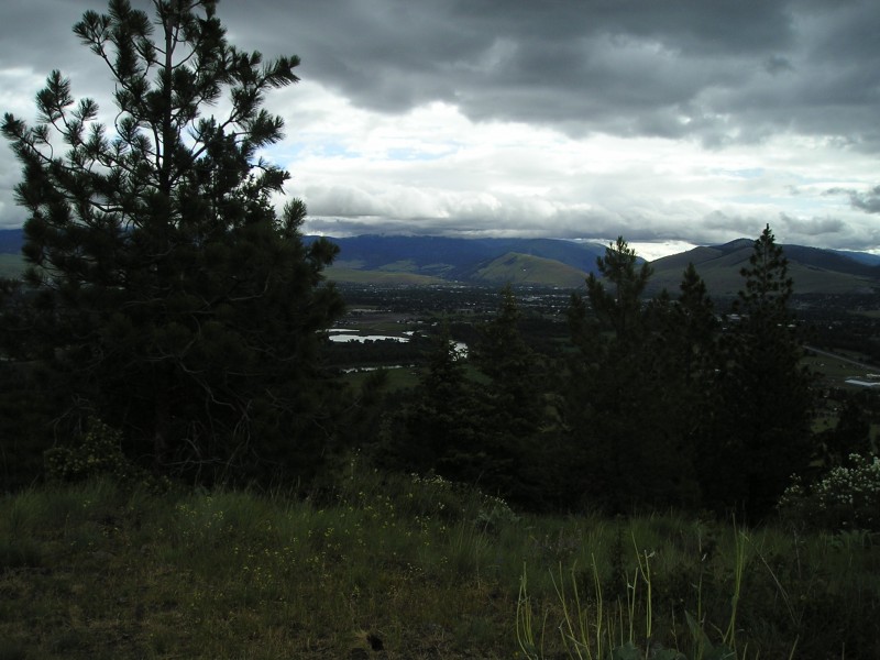
A good camping spot is only another half mile up on a peninsula overlooking the way you just came from and there’s a great view of the geologically interesting mountain line to the Southwest. The trail is rough but this view of Italian Peak is definitely worth packing in to see at sundown. If you can filter some water I would suggest hiking up to Italian Peak from this side. There is also a view of Scotts Peak just across the Idaho border if you get up a bit higher.

Note: Instead of finishing the 16 miles remaining in the loop after hiking back down the hillside, you can hike out the way that you came.

Don’t get it wrong: Jack loves a good road trip as much as the next guy.

But when it comes to hitting the trails, let’s just say sometimes he gets a little more enthused when the sofa isn’t too far away.

It’s true: Whereas some children have security blankets; Jack has a security sofa.
So in honor of that – as well as the unpredictable nature of all the wildfires across western Montana – Jack’s going to share some of his favorite close-to-Missoula hikes.

Check ’em out, and don’t forget to CLICK HERE to register for a free auto detail courtesy of Lithia Ford of Missoula!


1. Rattlesnake Main Trail, #515

An easy stroll along Rattlesnake Creek that satisfies all ages and most abilities

The Rattlesnake Recreation Area and Wilderness are the closest wilderness areas to a major metropolitan area in the United States!  They are comprised of 61,000 acres – 33,000 of which are designated wilderness.  There are more than 73 miles of trails that are great for activities such as hiking, biking, skiing, horseback riding, fishing and more.

From the main Rattlesnake trailhead, head down the wide trail (a single-lane former logging road).  After a quarter mile you’ll see Rattlesnake Creek on your right.  At 0.4 miles there is a horse bridge that goes over the creek.  If you’re lucky you’ll see an American dipper hopping around on the rocks below.  This is a lovely spot for the kids to play in the water or to have a picnic.

At 0.6 miles, a small trail splits off to the right off of the main trail.  If you take this trail, you’ll hike closer to the creek for the next mile.  If you stay on the main trail, you can go another 15 miles!  Take the smaller trail on the right that follows the creek.  Here you’ll be hiking through Ponderosa pine/Douglas fir forest with an under-story of primarily nine-bark.  Look for lady slipper orchids, buttercups and even trillium.

At 1.7 miles this narrow river trail meets back with the main trail.  Stay on the main trail until you come to an outhouse (3 miles).  From this point on, you are officially in the wilderness and permitted to camp.  Turn around here or if you’ve got time for a deeper foray into the wilderness keep going!

How to get there: From Missoula, head north from Broadway onto Van Buren St. (near Eastgate Shopping Center). Cut under the freeway, and Van Buren will eventually turn into Rattlesnake Drive.

Continue about three miles until you reach the Rattlesnake National Recreation Area entrance.

2. Vista Point Loop

A pretty little loop in south Missoula with great views

Blue Mountain Recreation Area is in the Missoula Ranger District of the Lolo National Forest and is located only 2 miles south of town. This area was part of the Missoula Military Reservation until 1952.

There are 41 miles of trail here, including 9 miles of the Blue Mountain National Recreation Trail (NRT).  Dogs are allowed to be off-leash, making this a favorite hiking area for folks with dogs.

From the trailhead, take trail 3.04 through the big field. This is a one-lane former road. At 0.75 miles the trail curves to the right then heads north along the base of the mountain.

After about 1.25 miles on trail 3.04, go left on trail 3.06. At 100 yards you’ll see a strangely bent tree. After passing the tree, you switchback up the hill for approximately 0.75 mile to Vista Point where you’ll have great views of the Bitterroot River and the Missoula valley.

From the top of Vista Point go down the backside (southwest). At 0.25 mile there is a junction of trails 3.06 and 3.05. Go right on trail 3.05 and head downhill. Hike 200 yards and turn right at trail 3.03. You’ll pass a very large rock sitting by itself. After 0.5 mile from the top of Vista Point you’ll join the original road/trail 3.04 (point “D” on map). Go right and follow the old road back along the base of the mountain and through the field to the trailhead.

How to get there: From Missoula, head south on Brooks like you are headed towards Lolo and the Bitterroot Valley, but just after leaving Missoula proper you’ll hit a stoplight at Blue Mountain Road. Turn right here and then head another half-mile to its junction with Forest Hill Road.

Turn left here and you’ll be at the parking lot.

3. Pengelly Ridge Trail

A heart-pumping hike to the top of Mount Sentinel

This is a challenging but rewarding route to the top of the south side of Mount Sentinel that is sparsely used, as opposed to the more popular hike to the “M”. It is named after David Pengelly, a Missoula lawyer who died at the age of 52 in a climbing accident.

It starts on the edge of the residential Pattee Canyon neighborhood and follows the short “Mo Z” trail before climbing the single-track trail to the top of the mountain.

The first 50 yards of the trail is very steep. At the top, the trail splits. Take the trail on the right, between the 2 Ponderosa pines. You will wind your way up to a gravel road in about a third mile. Make a right and follow the road until you see a major junction and the wood sign for Crooked Trail (which you will not take). The trail that you want is the narrow dirt single-track that heads up.

From here, you will climb up and up and up on a single-track dirt trail. You will still be in a native prairie habitat composed of lots of native bunchgrasses and some spotted knapweed. You may see whitetail or mule deer, hear western meadowlarks and see large raptors such as red-tailed hawks or turkey vultures overhead.

After about a half-mile heart-pounder, you will enter a small patch of trees and see some rocks at the base of trees that are painted with pictures. Keep climbing uphill along the trees on the narrow trail another third mile until you get to the stone plaque on the ground dedicated to David Pengelly. At this point, you can turn around and go back down the way you came up, or continue on.

Shortly after you find the stone plaque and you turn around and head back down the mountain the trail will split. Take the LEFT trail. If you take the trail on the right, you will head steeply down across the mountain toward the “M” above the University of Montana campus.

How to get there: From downtown Missoula, head south down Higgins Avenue to where it begins to curve west. Turn left onto Pattee Canyon Drive here, and head up about .6 miles to the parking strip on the your left.

The parking area is at a natural gas utility substation with a chain link fence around it. Look for the trailhead sign at the green metal gate.


Hike close to home with Jack!
Let Jack and Lithia guide your summer!

Let’s get this straight: Jack does NOT like to change out of his sweatpants.

HitTheRoadJack PHOTO2He’s much more of a “stay in and enjoy the great indoors” kind of guy.

But that’s all going to change this summer thanks to the leadership of his new BFF, Lithia Ford of Missoula.

The two have partnered up to put together a plan of action for making this summer a memorable one, and they’re going to make sure you benefit as well.

So what do you need to do? Join Jack in peeling off those crusty winter sweatpants, go put some freaking gas in the car finally and rouse your friends from their winter hibernation – cuz it’s time to hit the road!


Click HERE for Jack’s most recent travel blog of suggested destinations and activities.

Or skip all that and just head straight HERE to sign up for freebies from Lithia. This month, with a free tire mount and balance!


LithiaLogoFollow 105.9 Jack FM on Facebook and stay on top of his website for a new road trip adventure every week, plus plenty of cool prizes and giveaways to help you get out the door.

Hit the Road Jack is brought to you ALL SUMMER long by Jack and his new pal, Lithia Ford of Missoula – where you can now get $19.99 oil changes and convenient service help every single day of the week, including Saturdays and Sundays!